


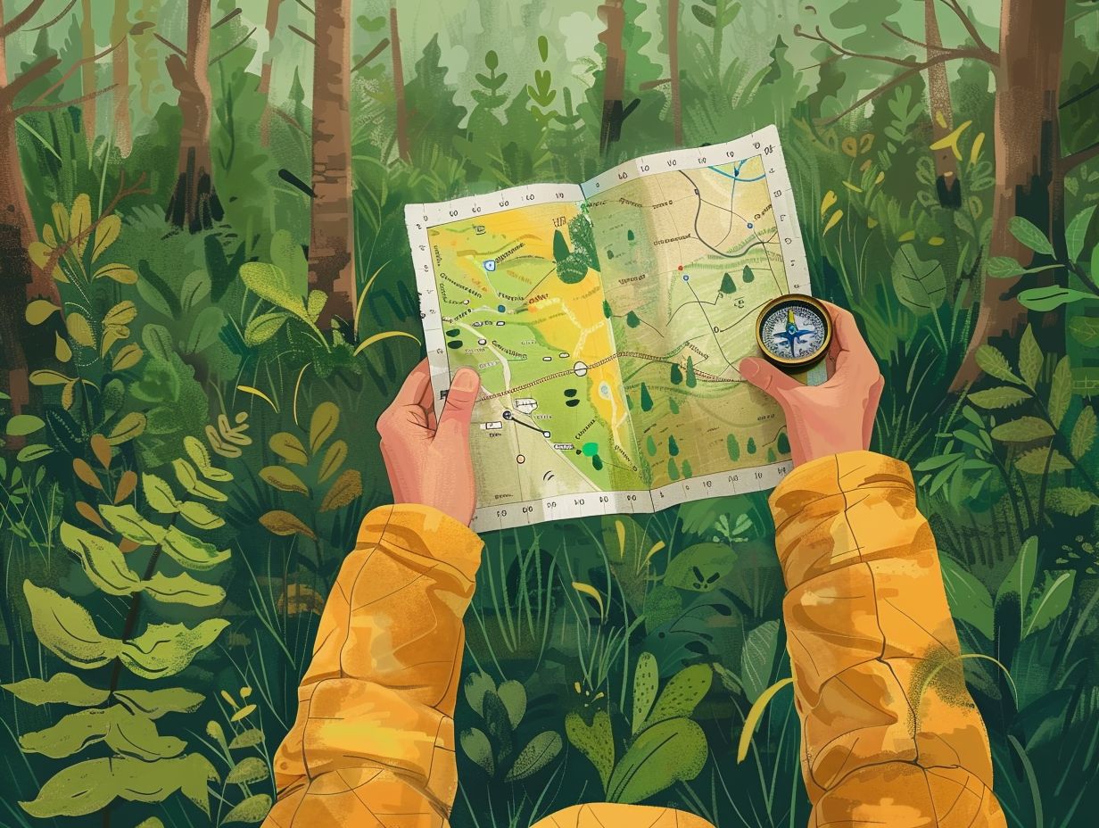

Map and compass navigation is a valuable skill for outdoor enthusiasts, hikers, and adventurers alike.
Explore the importance of using a map and compass, advantages and limitations of these tools, and essential features of a map.
Learn about the different types of compasses, how to read a map effectively, and how to use a compass for accurate navigation.
Whether you’re a beginner or seasoned navigator, these tips and techniques will help you navigate with confidence in the great outdoors.
Key Takeaways:
- Map and compass navigation is essential for safe and successful outdoor adventures.
- Advantages include accurate distance and direction measurements, while limitations include potential for human error.
- Understanding map features and compass use, including adjusting for magnetic declination, are crucial for effective navigation.
How to Read a Map?
The accurate interpretation of a map requires an understanding of map symbols and legends, the decoding of contour lines to assess the topography, and the use of grid references for precise navigation.
Understanding Map Symbols and Legends
A thorough understanding of map symbols and keys is essential for accurately interpreting the information conveyed on maps, particularly those produced by organizations such as USGS and Green Trails Maps.
Symbols, like contour lines found on maps, indicate changes in height, where closely spaced lines represent steep terrain and widely spaced lines show more gentle slopes. Moreover, symbols representing landmarks, campsites, and trailheads help walkers navigate precisely.
USGS maps often include scales and grids to aid in measuring distances, while Green Trails Maps use a color-coded system to differentiate between various types of land cover.
Proficiency in interpreting these symbols significantly improves an individual’s ability to plan routes, identify key locations, and make well-informed decisions during outdoor adventures.
Interpreting Contour Lines
The interpretation of contour lines on a map is a fundamental skill necessary for gaining insights into the elevation and slope of the terrain. This knowledge is essential for effective navigation and route planning.
By analysing the spacing, shape, and patterns of contour lines, individuals can discern the steepness of slopes and identify prominent features such as ridges, valleys, and saddles. The United States Geological Survey (USGS) maps employ contour lines as a method to represent changes in elevation, with each line denoting a specific level of elevation.
A comprehensive understanding of how contour lines function is imperative for hikers, backpackers, and outdoor enthusiasts, as it enables them to anticipate alterations in terrain, strategise safe routes, and steer clear of potentially dangerous areas.
Proficiency in interpreting contour lines give the power tos adventurers to navigate various landscapes with heightened precision and safety, instilling them with confidence in their exploration endeavours.
Using Grid Coordinates for Navigation
Utilising grid coordinates on maps facilitates accurate navigation, enabling individuals to pinpoint precise locations and plan routes effectively, as exemplified in both USGS and Green Trails Maps.
These cartographic representations feature a grid overlay that allocates a unique combination of alphanumeric characters to designated points on the map.
For example, a USGS map may display grid coordinates such as 38°52’08″N 77°02’46″W, denoting a specific location in terms of latitude and longitude coordinates. Similarly, Green Trails Maps employ a grid system with alphanumeric codes to designate locations.
By consulting these coordinates, hikers, adventurers, and emergency responders can expediently locate particular destinations, ensuring secure and efficient navigation across diverse terrains.
How to Use a Compass?
To use a compass efficiently, it is essential to understand the process of adjusting for magnetic declination, aligning the map in conjunction with the compass, and determining direction with precision. Models such as the Suunto M-3 NH and Brunton Model 9077 offer reliable features suitable for accurate navigation.
Adjusting for Magnetic Declination

Correcting for magnetic declination is an essential aspect of compass navigation to ensure the accuracy of compass readings, a process that can be facilitated by utilising USGS maps and NOAA Geomagnetic Data.
Magnetic declination refers to the angular variance between true north and magnetic north, stemming from fluctuations in the Earth’s magnetic field. Failure to consider this variance can result in significant navigational errors.
When compensating for magnetic declination with the assistance of USGS maps, the initial step involves identifying the declination value on the map corresponding to your geographical location. Subsequently, you must ascertain whether the declination is east or west of true north. Finally, incorporate this value by either adding or subtracting it from your magnetic readings to determine true north.
For more precise adjustments throughout your journey, NOAA’s Geomagnetic Data furnishes updated declination values to aid in accurate navigation.
Orienting the Map with the Compass
Orienting a map with a compass is a fundamental navigational skill that allows individuals to align a map accurately with the actual terrain. Compasses such as the Suunto M-3 NH and Brunton Model 9077 are essential tools for this purpose.
To start this process, it is advisable to place the map on a flat surface and ensure the compass is held level in hand. Using the baseplate ruler of the Suunto M-3 NH, one can measure the distance between two points on the map.
Subsequently, the compass housing should be rotated until the orienting lines coincide with the north-south grid lines on the map. Similarly, the Brunton Model 9077 allows users to use the rotating bezel to achieve the same alignment. Once the compass and map are properly aligned, individuals can confidently navigate through the terrain with enhanced precision.
Using the Compass to Determine Direction
Using a compass to determine direction is a key skill in navigation, helping individuals to find their orientation and keep on the right path throughout their journey.
For effective use of a compass in navigation, the first step involves placing the map on a flat surface and ensuring that the directional arrow of the compass matches the north indicated on the map. Then, keeping the compass flat, the individual must turn both themselves and the compass until the needle lines up with the orienting arrow, showing the desired direction.
To set a bearing, it is crucial to adjust the compass bezel so that the north aligns with the direction of travel arrow. Holding the compass in front and turning one’s body until the needle realigns with the orienting arrow helps determine a bearing, aiding in staying on the correct path while crossing varied terrains.
Tips for Successful Map and Compass Navigation
Effective navigation using a map and compass requires regular practice, thorough understanding of the tools at your disposal, and meticulous observation of landmarks and terrain characteristics, as advised by reputable sources such as Outside+.
Practice and Familiarise Yourself with Your Tools
It is essential to engage in regular practice and familiarise oneself with map and compass tools in order to develop reliable navigation skills.
Consistent practice with maps and compasses in diverse terrains and conditions is advantageous for refining navigation abilities. Utilising these tools frequently in various environments such as forests, mountains, or urban areas can improve proficiency in map reading and the accurate use of a compass for directional orientation.
Additionally, to enhance skill development, creating simulated scenarios where one is tasked with navigating from point A to point B using solely a map and compass can be beneficial. These practical exercises serve to increase confidence and adeptness in navigation techniques, thereby preparing individuals for outdoor expeditions.
Pay Attention to Landmarks and Terrain Features
It is essential to focus on landmarks and terrain features for effective navigation, as these visual indicators play a crucial role in verifying one’s position and staying on course.
Landmarks, such as distinct peaks or notable trees, can act as reliable reference points on a map, allowing for the correlation of real-world observations with corresponding elements on the map.
By identifying these landmarks and examining terrain characteristics like rivers, valleys, or ridges, individuals can accurately determine their current position and monitor their advancement.
This practice proves particularly valuable when combined with a compass, as comprehending how the terrain aligns with cardinal directions enhances one’s navigational abilities, enabling confident and precise manoeuvring across diverse landscapes.
Frequently Asked Questions

What is the purpose of using a map and compass for navigation?
The purpose of using a map and compass for navigation is to determine your current location and the direction you need to go in order to reach your desired destination. It helps you to stay on track and avoid getting lost.
How do I read a map?
To read a map, first determine the map’s orientation (north, south, east, west). Then look for landmarks such as roads, rivers, and mountains to get a sense of the surrounding area. Pay attention to the map’s scale and legend to understand the distance and symbols used. Lastly, use a compass to align the map with your surroundings for more accurate navigation.
How do I use a compass with a map for navigation?
To use a compass with a map, first align the map with the compass by placing the compass on the map and turning the map until the compass’s north arrow is pointing towards the map’s north. Then, hold the compass flat and rotate your body until the compass’s north arrow is aligned with the red magnetic needle. The direction you are facing is your desired direction of travel.
What if my map does not have a compass rose?
If your map does not have a compass rose, you can use a physical compass to determine the map’s orientation. Simply place your compass on the map and rotate the map until the compass’s north arrow is pointing towards the compass’s red magnetic needle. This will align the map with your surroundings and allow for accurate navigation.
What are some common mistakes when using a map and compass for navigation?
Some common mistakes when using a map and compass for navigation include not orienting the map correctly, not taking into account declination (the difference between true north and magnetic north), not following a straight bearing, and not updating your location as you move. It is important to always double check your work and be aware of potential errors.
Can I solely rely on a map and compass for navigation?
While a map and compass are essential tools for navigation, it is important to also have backup methods such as a GPS device or physical landmarks. Always be prepared and use multiple methods for navigation to ensure accuracy and avoid getting lost.

A Seasonal Guide To Hiking In The Peak District
Are you ready to lace up your hiking boots and explore the stunning landscapes of the Peak District? This seasonal guide will take you through

Hiking Challenges Preparing For Your First Ultrahike
Are you ready to take your hiking adventures to the next level? Ultra-hiking offers a unique combination of physical and mental challenges, breathtaking scenery, and

Ecofriendly Hiking Tips For Sustainable Adventures
Are you an outdoor enthusiast looking to minimise your impact on the environment while enjoying the great outdoors? Eco-friendly hiking is the perfect solution! We

The Best Hiking Trails For Experiencing UK Wildlife
When exploring the picturesque hiking trails of the UK, you can expect to encounter a diverse array of wildlife. From majestic birds soaring overhead to

Wildflower Walks The Best Trails For Nature Lovers
Are you a nature lover looking to embark on a wildflower walk? Explore the best trails for wildflower walks, including [Trail Name 1], [Trail Name