Are you an outdoor enthusiast looking to enhance your navigation and camping experience? Look no further!
We have compiled a list of the top 10 outdoor navigation and camping apps that will revolutionize your adventures. From trail mapping to campsite locating, these apps have got you covered.
Plus, we’ll provide you with some handy tips on how to make the most out of these apps. So, grab your gear and get ready to explore the great outdoors like never before!
Key Takeaways:
- Discover new trails and routes with apps like AllTrails and Gaia GPS.
- Maximise battery life and prepare for emergencies by bringing a backup battery and familiarizing yourself with app features.
- For added safety and convenience, use outdoor navigation apps in conjunction with a physical map.
The Top Outdoor Navigation and Camping Apps
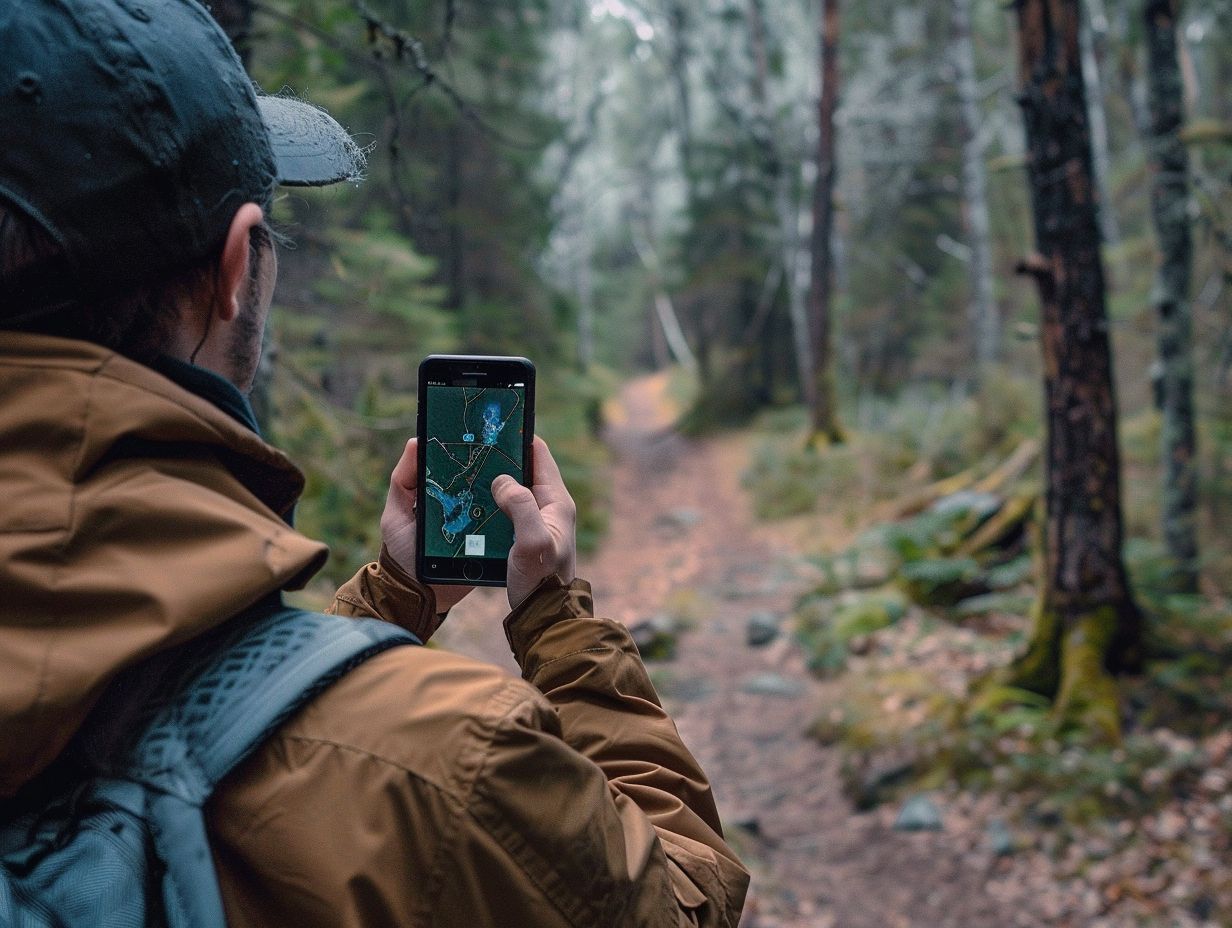
Over the recent years, hiking applications have evolved into essential tools for outdoor navigation, facilitating the exploration of national parks and wilderness areas through smartphones equipped with GPS and offline maps.
These applications offer a wide array of functionalities, including trail guides, topographic charts, emergency tools, and compass features, harnessing sophisticated digital technology to enrich outdoor excursions.
Prominent hiking apps such as ViewRanger Skyline, Backcountry Navigator, and Gaia GPS have consistently established themselves as industry benchmarks, while emerging platforms like Hiiker.app and Chimaini are also gaining recognition.
Renowned outdoor enthusiasts like Alex Roddie and Chris Townsend have emphasized the significance of these applications in modern hiking expeditions.
1. AllTrails
AllTrails stands out as a highly esteemed hiking application, recognised for its extensive trail guides and maps, positioning it as an essential resource for individuals seeking to explore national parks and various hiking trails.
Through AllTrails, users gain access to detailed maps that furnish essential details on trail difficulty, elevation gain, and distance, thereby enabling them to select routes aligned with their preferences and capabilities. The platform’s user-generated trail guides offer valuable insights and recommendations from fellow hikers, fostering a community-driven experience.
Whether navigating trails in national parks or venturing into remote natural settings, the robust features of AllTrails give the power to outdoor enthusiasts to uncover new trails, share favoured routes, and contribute to a dynamic network of trail exploration.
2. Gaia GPS
Gaia GPS is distinguished by its comprehensive topographic charts and offline navigation capabilities, making it a preferred choice among outdoor enthusiasts who depend on precise GPS information.
The detailed topographic charts offered by Gaia GPS provide intricate terrain information that is essential for hikers, campers, and mountaineers navigating through challenging landscapes.
The offline functionality ensures uninterrupted navigation, even in remote areas where internet connectivity is limited or unavailable, offering a sense of assurance to adventurers exploring off-the-grid locations.
Gaia GPS’s precision in GPS navigation sets it apart, providing users with accurate guidance that leads to safer and more effective journeys in the wilderness. The reliability of Gaia GPS in delivering real-time location data give the power tos outdoor enthusiasts to plan and execute their adventures with confidence.
3. ViewRanger
ViewRanger, particularly with its Skyline feature, provides advanced tools such as an augmented reality compass and emergency safety features, thereby enhancing the safety and enjoyment of every outdoor excursion.
The Augmented Reality (AR) capabilities inherent in the ViewRanger Skyline feature deliver a distinctive experience to users by superimposing digital data onto real-world terrains, thereby facilitating more intuitive and engaging navigation.
The inclusion of an integrated compass guarantees that adventurers maintain a clear sense of direction, particularly in regions with limited visibility or instances where electronic devices may encounter signal disruptions.
Moreover, in instances of emergencies, the incorporated tools enable swift access to vital information, including location sharing and emergency contacts, thereby ensuring peace of mind and expeditious responses in potentially hazardous scenarios.
4. Komoot
Komoot demonstrates excellence in providing personalised routes and detailed maps tailored to enhance outdoor experiences for walkers, cyclists, and other outdoor enthusiasts.
Through the utilisation of user preferences and input, Komoot’s innovative platform offers customised route planning that takes into account various factors, including terrain, difficulty levels, and points of interest.
The maps provided by Komoot are intricately detailed, encompassing features such as elevation profiles, landmarks, and trail conditions, thereby ensuring a seamless navigation experience.
Plus catering to hiking enthusiasts, Komoot exhibits its versatility by supporting a wide array of outdoor activities, such as mountain biking, road cycling, running, and water sports. Users can benefit from community-sourced recommendations to explore new trails, uncover hidden gems, and identify essential destinations relevant to their chosen recreational pursuits.
5. MapMyHike

MapMyHike utilises GPS technology to deliver real-time data and trail guides, rendering it a valuable tool for hikers who utilise smartphones.
The application’s GPS tracking functionalities enable users to precisely monitor their hiking activities, track their advancement, and access comprehensive maps of their chosen routes. The instantaneous updates on metrics such as distance travelled, elevation gained, and pace attained serve to keep hikers well-informed and motivated throughout their excursions.
Furthermore, MapMyHike presents trail guides containing details concerning difficulty levels, notable points of interest, and recommended equipment. By seamlessly integrating with smartphones, this application enriches the hiking experience by affording convenience and offering pertinent insights to outdoor enthusiasts.
6. Hiking Project
The Hiking Project provides an extensive database of maps and routes that have been contributed by a dedicated community of hikers, thus establishing itself as a valuable resource for individuals seeking to plan outdoor excursions.
Regardless of whether one is an experienced hiker in search of new challenges or a beginner hoping to explore local trails, the diverse range of trail options available on the Hiking Project caters to all skill levels and preferences.
By leveraging the combined expertise of fellow outdoor enthusiasts, users are able to uncover both hidden gems and popular paths, thereby fostering a sense of camaraderie and shared exploration.
The interactive features of the platform enable hikers to share their experiences, provide tips, and showcase photos, thus cultivating a dynamic community wherein individuals can engage, educate, and motivate one another.
7. PeakFinder AR
PeakFinder AR utilises cutting-edge technology to provide users with augmented reality views of mountain peaks, in conjunction with compass and topographic chart functionalities.
The augmented reality capabilities of PeakFinder enable users to effortlessly point their device’s camera towards the landscape, prompting the application to superimpose digital labels identifying the mountains within the view.
This technological innovation offers a distinctive and engaging method for outdoor enthusiasts to familiarise themselves with their environment and strategise their hiking routes. Moreover, apart from peak identification, PeakFinder incorporates a compass feature that assists users in orienting themselves and navigating efficiently through unfamiliar terrains.
Complementing this functionality, the app’s topographic charts enrich the user experience by furnishing detailed elevation data and terrain mapping, rendering it a comprehensive tool for outdoor exploration.
8. Spyglass
Spyglass is a versatile app that melds a robust compass with GPS navigation and essential emergency tools, catering to a wide array of outdoor pursuits.
By employing the compass feature, users are able to easily discern their direction by aligning it with either visible landmarks or celestial bodies. In critical situations, the application offers a range of tools for signalling distress, whether through light, sound, or Morse code.
Tailored for activities such as hiking, camping, boating, and geocaching, Spyglass furnishes users with precise location data, topographic maps, as well as the capability to establish waypoints and monitor routes.
Whether venturing into unfamiliar landscapes or undertaking a rugged backcountry escapade, Spyglass furnishes adventurers with essential navigation aids and safety provisions.
9. iOverlander
iOverlander constitutes an essential application for explorers, providing comprehensive maps and pathways suitable for overlanding and prolonged outdoor excursions.
The application offers an array of features specifically designed to accommodate the requirements of individuals passionate about road trips. These features include suggesting camping locations and accommodation options, as well as aiding in the planning of daily travel schedules.
Through iOverlander, travellers can effectively navigate unfamiliar territories, ensuring a smooth and secure expedition.
Its adventure-centric features enable users to discover hidden gems away from traditional routes, thus enhancing the excitement and memorability of extensive journeys. By using iOverlander, individuals setting off on road trips and expeditions can approach new adventures with confidence, comforted by the presence of a reliable companion to guide them along their journey.
10. Campendium
Campendium is an app that provides extensive maps and user reviews of campsites, with a particular focus on those located in national parks, positioning it as a preferred choice among camping enthusiasts.
The detailed campsite maps available through Campendium serve as a valuable tool for campers in search of the ideal location to pitch their tent or park their caravan. Within the app, users can easily navigate through various campsites, using filters to customise their search according to specific facilities and preferences.
The user reviews featured on the app offer first-hand experiences and insights, helping others make well-informed decisions regarding their accommodation choices.
For campers planning trips to national parks, this application proves to be highly beneficial, as it provides essential information on campsites located within these renowned outdoor destinations, thus simplifying and enhancing the trip planning process.
Tips for Using Outdoor Navigation and Camping Apps
The effective utilisation of hiking apps for outdoor navigation and camping necessitates the execution of several crucial steps. These steps include:
- Downloading maps and trail guides in advance to guarantee offline accessibility.
- Carrying a backup battery to mitigate the risk of smartphone power depletion.
- Acquainting oneself with the distinct functionalities of each application.
The integration of these apps with conventional navigation instruments like physical maps and compasses can notably enrich one’s exploratory endeavours in national parks and remote regions.
By capitalising on digital technology and emergency resources offered by applications such as ViewRanger Skyline, Backcountry Navigator, and Gaia GPS, individuals can ensure a safer and more gratifying outdoor excursion.
1. Download Maps and Trails Beforehand
It is essential to download maps and trail guides in advance to ensure access to critical navigation information offline, even in the absence of a GPS signal. This practice holds particular significance in remote areas where GPS signals may be unreliable or completely unavailable.
By preloading maps on a smartphone or tablet, individuals can prevent getting lost and navigate their surroundings confidently. Applications such as AllTrails, Gaia GPS, and Maps.me enable users to download maps for offline utilisation, providing reassurance during outdoor excursions.
The availability of detailed trail guides and maps while exploring remote locales can significantly improve overall experiences and safety levels.
2. Bring a Backup Battery
It is essential to have a backup battery for your mobile phone, especially when relying on hiking apps and emergency tools during extended outdoor adventures.
In circumstances where one may be distant from electrical sockets for prolonged periods, a backup battery can prove to be invaluable. Consider a situation where you find yourself in the midst of a forest and require access to your GPS for navigation; a fully charged backup battery can guarantee a safe arrival at your destination.
In times of emergencies, such as the need to contact authorities or loved ones, a functional phone is imperative. A backup battery offers an additional layer of security and peace of mind, enabling individuals to remain connected even in remote locations with limited power sources.
3. Familiarise Yourself with the App’s Features
Acquainting oneself with the application’s features, such as trail guides and route planning, is essential to fully capitalise on its capabilities during the hiking expedition.
Following a comprehensive understanding of these features, it becomes imperative to delve into the application’s functionalities to enrich the outdoor experience further.
It is advisable to thoroughly investigate features like offline maps, real-time weather updates, and emergency contact information. Proficiency in utilising these tools adeptly can prove critical for a successful and secure journey.
Before embarking on the hike, it is advisable to engage in practice sessions using the application, thereby pre-emptively addressing any potential issues that may arise and ensuring a seamless navigation experience.
By achieving proficiency in these features beforehand, individuals can instill confidence in their ability to navigate trails competently and relish their outdoor activities to the fullest extent.
4. Use the App in Conjunction with a Physical Map
Utilising the application alongside a physical map and compass can augment one’s outdoor navigation proficiency and offer a dependable contingency plan in the event of technological malfunction. A physical map and compass serve as essential fallback options, particularly when electronic devices experience battery depletion or signal loss.
To optimise their utility, it is advisable to first acquire a firm grasp of fundamental map-reading and compass-navigation skills. Whilst the application can be leveraged for real-time tracking, it is imperative to acknowledge the inherent fallibility of technology.
By integrating traditional navigation instruments with digital resources, individuals can ensure preparedness for various scenarios. When engaging with hiking applications, it is prudent to judiciously alternate between offline and online modes, carry spare batteries, and maintain the physical map and compass as a reliable backup strategy.
Frequently Asked Questions
What are the best apps for outdoor navigation and camping?
Some of the best apps for outdoor navigation and camping include AllTrails, Gaia GPS, and Komoot.
What features should I look for in an outdoor navigation and camping app?
When selecting an app for outdoor navigation and camping, make sure it has features such as offline maps, trail tracking, and campsite information.
Can I use these apps for navigation without an internet connection?
Yes, many outdoor navigation and camping apps offer offline maps and GPS tracking, allowing you to navigate even without an internet connection.
Are these apps suitable for all types of outdoor activities?
Yes, these apps are designed for a variety of outdoor activities such as hiking, camping, biking, and even water sports.
Do these apps require a subscription or payment?
Some apps may require a subscription or payment for advanced features, but many offer a free version with basic functionalities.
Can I plan my camping trip using these apps?
Yes, many of these apps allow you to plan and customise your camping trip by selecting specific routes, campsites, and points of interest along the way.